
| Area | Southern Mattole |
| Topic | Temperature: Min, Max and Avg, Mattole River at Dream St, 2001 |
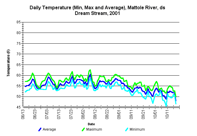
| Caption: Minimum, maximum, and average daily water temperatures for the Mattole River, approximately 50 feet downstream from the confluence of Dream Stream (~river mile 60.2). See the Chart Table Caption for site (stream) identifiers. | |
 |
To learn more about this topic click Info Links .
To view a table of information about this data click Metadata .
To view the table with the chart's data, click Chart Table web page.
To download the table with the chart's data, click mattemp01_mma.db (size 110,592 bytes) .
To view the table with the chart's source data, click Source Table web page.
To download the table with the chart's source data, click mattemp01.dbf (size 2,575,042 bytes)
| www.krisweb.com |