| Area |
Salmon Creek |
| Topic |
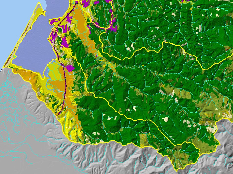
Map: G. USFS Vegetation Type, Salmon Creek Sub-basin |
To view a more detailed version of this map click
here
|
This is a map of 1999 USFS Landsat vegetation type data in the Salmon Creek sub-basin. Unlike the tree size, these data differentiate between hardwoods and
conifers. The vegetation classification is accurate at a one-hectare scale (approximately 11 pixels) and is suitable for stand classification. Data provided by the U.S.
Forest Service Spatial Analysis Lab in Sacramento, CA.
|
|
|
 |
 |
To view metadata about a map layer, click on a link in the table below.
If you obtain KRIS on a CD and install it on your hard drive as a desktop program, you will have access to increased map capabilities such as zooming in/out, turning layers on/off, adding layers and changing legends.