| Area |
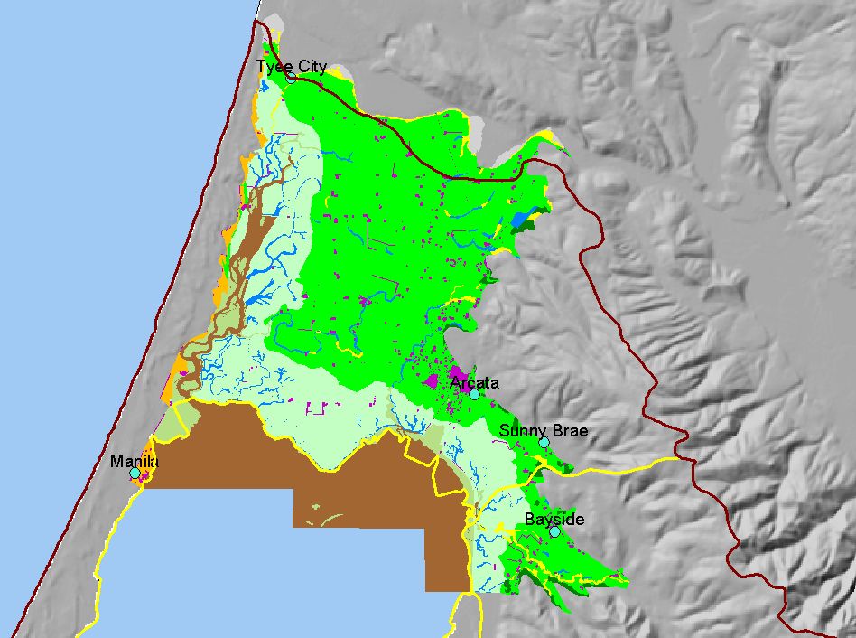
Arcata |
| Topic |
Map: P. Landuse Arcata Bottoms 1941, Arcata Sub-basin |
To view a more detailed version of this map click
here
|
This is a map of landuse in the Arcata Bottoms, circa 1941, based on digitized historic maps. The majority of land use was agricultural and diked bayland Click the
check box next to a layer to toggle it on/off. Other available layers include KRIS sub-basins, Calwater Planning Watersheds, Towns, and 1:100k roads and streams,
and 1:24k streams. Scale = 1:84,278 .
|
|
|
 |
 |
To view metadata about a map layer, click on a link in the table below.
If you obtain KRIS on a CD and install it on your hard drive as a desktop program, you will have access to increased map capabilities such as zooming in/out, turning layers on/off, adding layers and changing legends.