| Area |
Arcata |
| Topic |
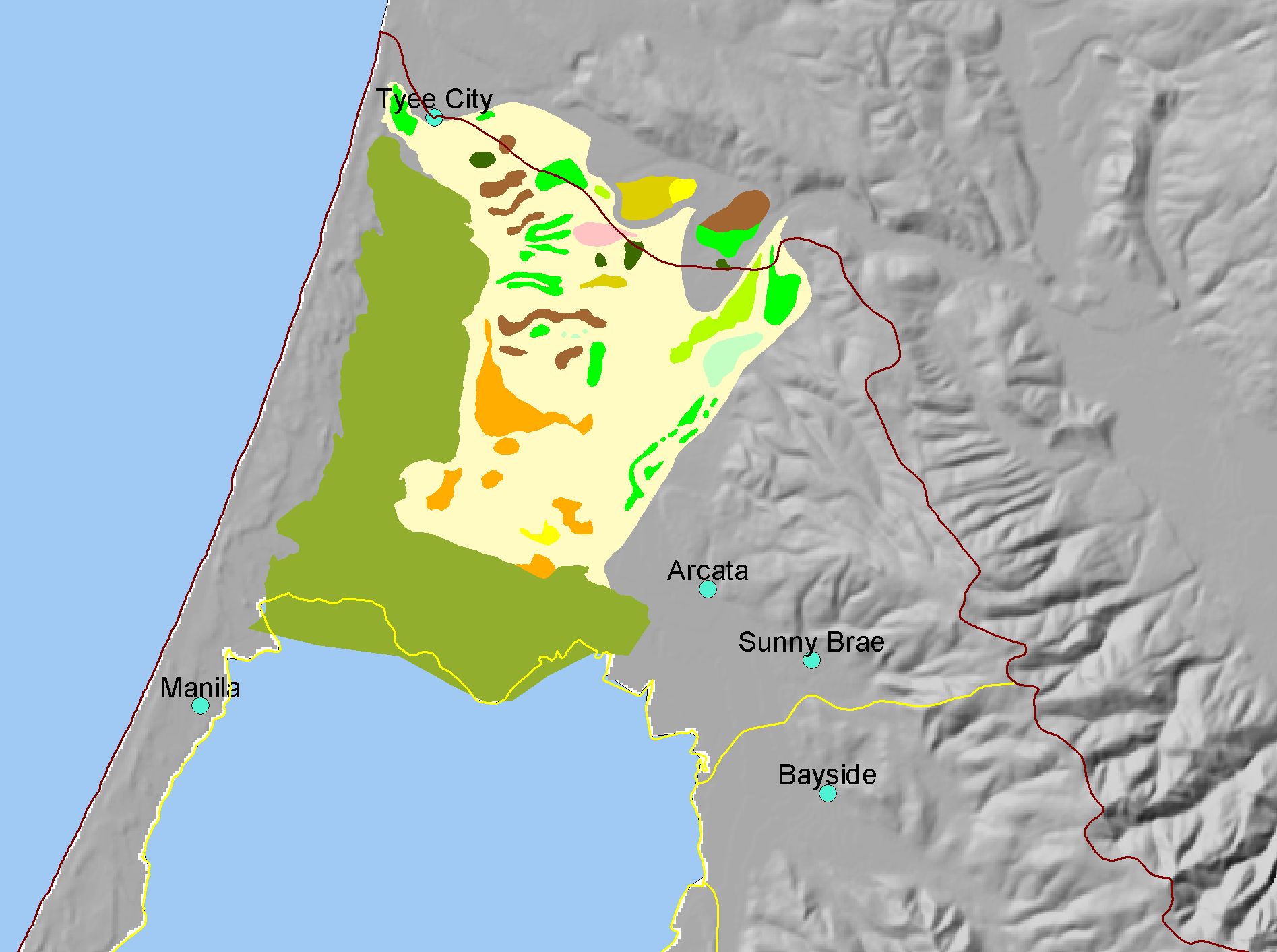
Map: O. Vegetation Arcata Bottoms 1870, Arcata Sub-basin |
|
This is a map of vegetation in the Arcata Bottoms, circa 1870, based on digitized historic maps. The majority of salt marsh and prairie, interspersed with hardwoods.
|
|
|
 |
 |
To view metadata about a map layer, click on a link in the table below.
If you obtain KRIS on a CD and install it on your hard drive as a desktop program, you will have access to increased map capabilities such as zooming in/out, turning layers on/off, adding layers and changing legends.