| Area | Caspar Creek |
| Topic | Sediment: V* from NF Caspar above the weir, 1991-2000 |
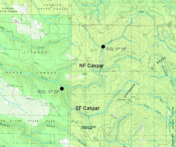
The map above shows the Redwood Sciences Lab V* reaches for the North and South Forks of Caspar Creek. The reaches measured extend upstream from the points shown above and include from 15 to 30 pools.
 Click on image to enlarge (151K).
To learn more about this topic click here
| www.krisweb.com |