
| Area | Basinwide/Regional |
| Topic | Sediment: Matthews Landslides Delivered by Sub-basin 1921-2000 |
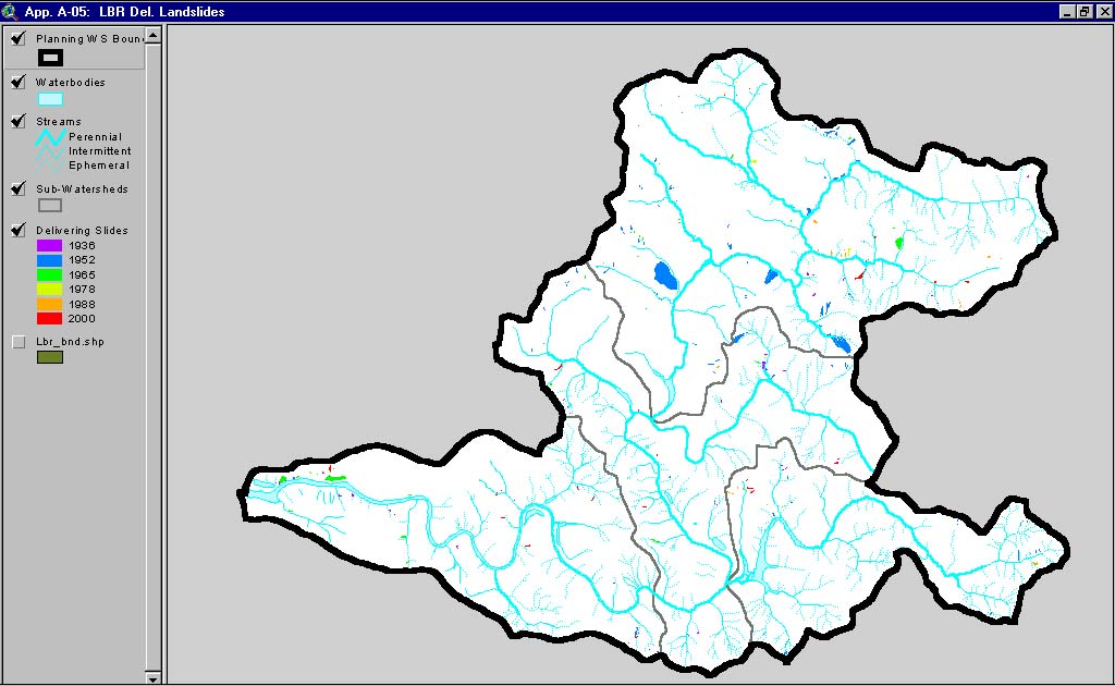
This image, from Matthews and Associates (2001) Appendix A-5, shows delivered slides mapped in the Lower Big River Planning Watershed. This watershed contains the western portion of the Lower Big River CalWater sub-basin, in addition to the Little North Fork CalWater basin.
This image, from Matthews and Associates (2001) Appendix A-4, shows delivered slides mapped in the Middle Big River Planning Watershed. This watershed contains the eastern portion of the Lower Big River CalWater sub-basin.
This image, from Matthews and Associates (2001) Appendix A-2, shows delivered slides mapped in the North Fork Planning Watershed. This watershed is the North Fork Big River CalWater sub-basin.
This image, from Matthews and Associates (2001) Appendix A-1, shows delivered slides mapped in the Headwaters Planning Watershed. This watershed is the Upper Big River CalWater sub-basin.
This image, from Matthews and Associates (2001) Appendix A-3, shows delivered slides mapped in the South Fork Planning Watershed. This watershed contains the South Fork Big River and Daugherty Creek CalWater sub-basins.
 Click on image to enlarge (120K).
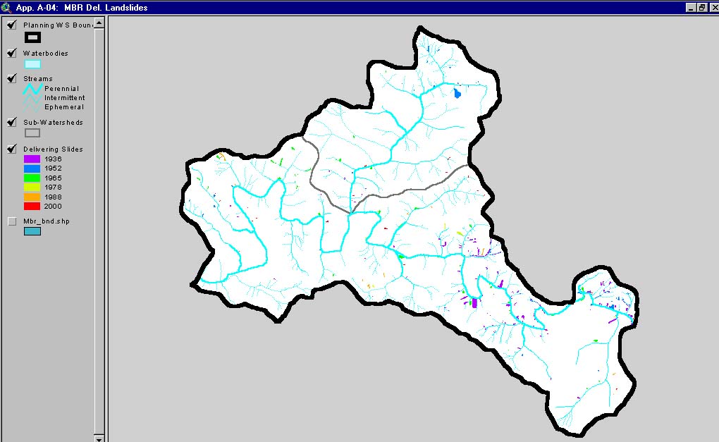 Click on image to enlarge (93K).
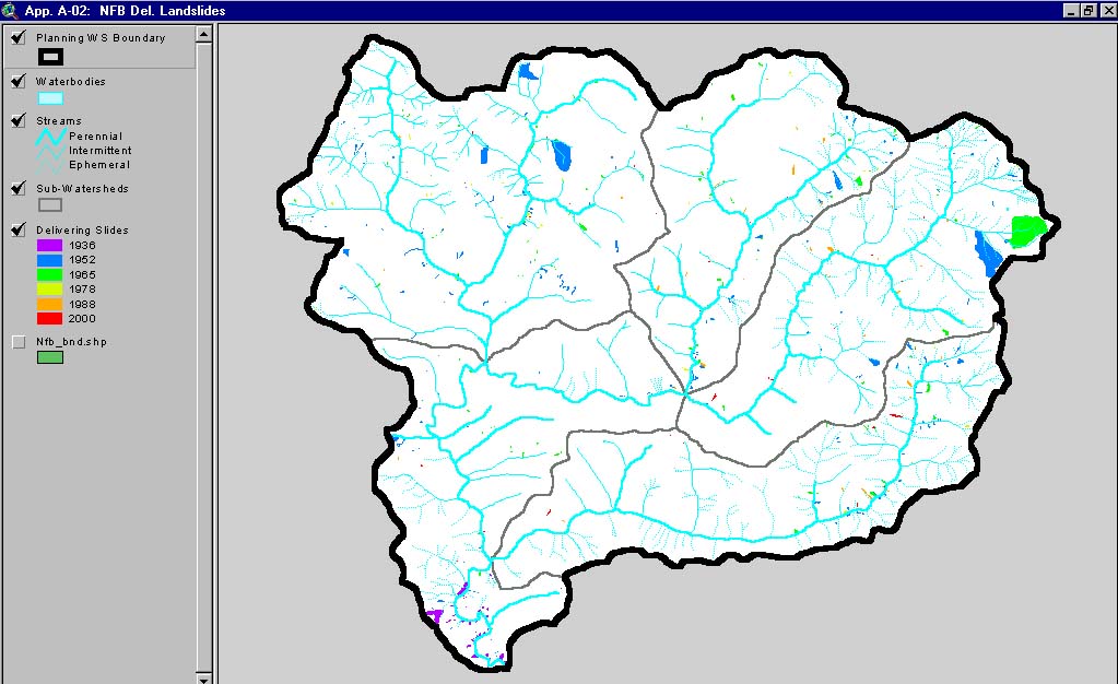 Click on image to enlarge (126K).
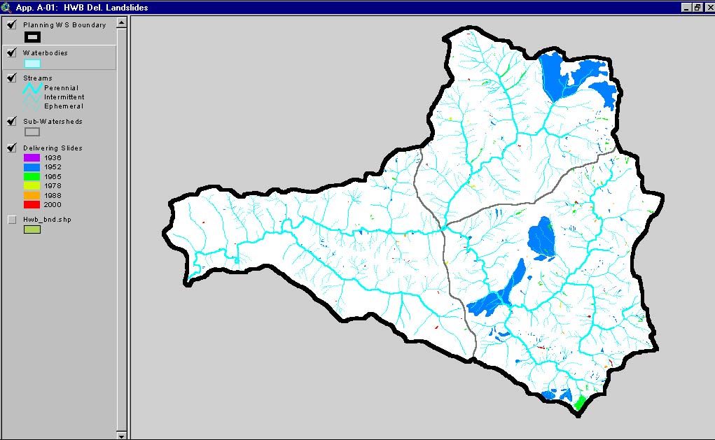 Click on image to enlarge (118K).
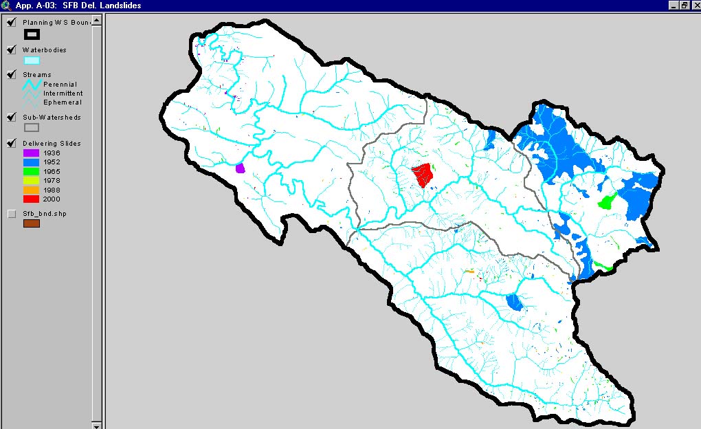 Click on image to enlarge (121K).
To learn more about this topic click here
| www.krisweb.com |