| Area |
Basin-wide |
| Topic |
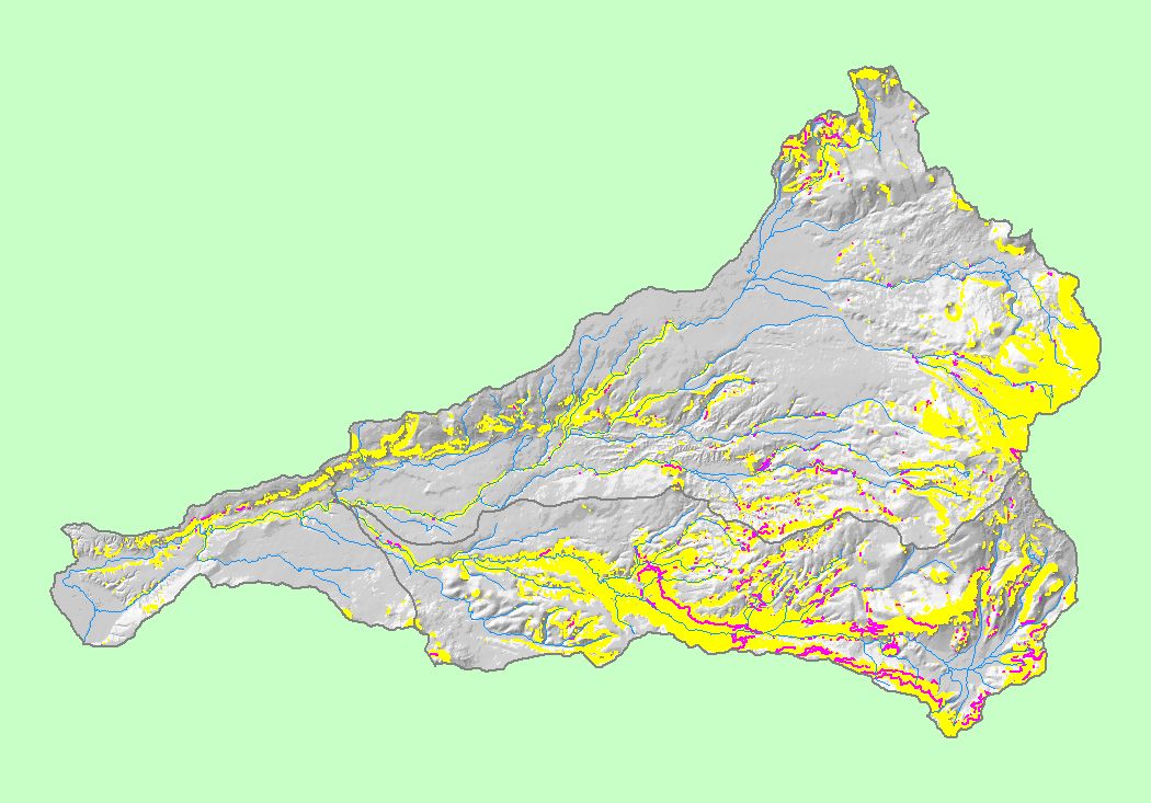
Map: 1G Roads on Steep Slopes, Battle Creek Basin |
To view a more detailed version of this map click
here
|
This map shows the areas in the Battle Creek basin with slopes greater than 35% (yellow polygons) and roads on steep slopes (pink lines), displayed with 1:100,000
scale streams, KRIS sub-basins and a grayscale elevation hillshade. Roads on steep slopes are more prone to erosion. Roads data were provided by Sierra Pacific
Industries and Lassen National Forest. Slopes greater than 35% were calculated from 30 meter U.S. Geological Survey Digital Elevation Model (DEM) data by the
KRIS team.
|
|
|
 |
 |
To view metadata about a map layer, click on a link in the table below.