| Area |
S Marin/Redwood Creek |
| Topic |
WQ: Specific Conductance in Laurel Creek 2000 |
|
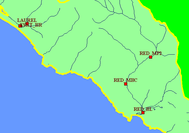
This is a map of GOGA water temperature and water quality monitoring stations in the Golden Gate National Recreation Area.
|
|
|
 |
 |
To view metadata about a map layer, click on a link in the table below.
| Name of Layer in Map Legend | Metadata File Name |
|---|
| GOGA Temperature/WQ Sites | goga_wq_temps.shp.txt |
| KRIS subbasins | subbasins.shp.txt |
| Streams (1:24,000 scale) | streams24.shp.txt |
| Frame Project Outline | Unavailable |
| Topo Map, South (1:24k scale) | Unavailable |
| Project Background | Unavailable |