| Area |
Lagunitas Creek |
| Topic |
Temperature: Lagunitas Cr Min, Max and Average @ Kent 2001 |
|
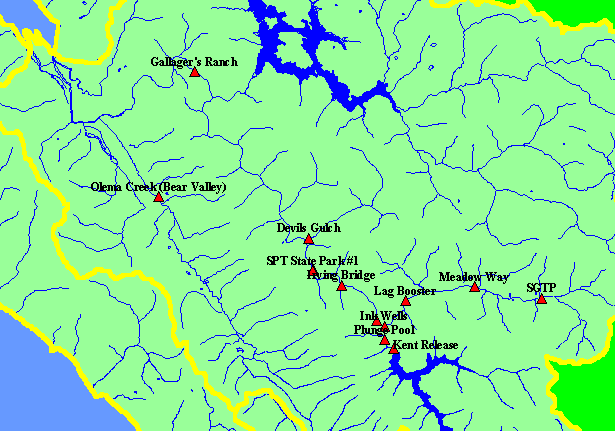
This is a map of Marin Municipal Water District water temperature monitoring stations on Lagunitas Creek and its tributaries.
Displayed in the background are 1:24,000 scale hydrography and KRIS sub-basins.
|
|
|
 |
 |
To view metadata about a map layer, click on a link in the table below.
| Name of Layer in Map Legend | Metadata File Name |
|---|
| MMWD Temperature Sites | mmwd_temps.shp.txt |
| KRIS subbasins | subbasins.shp.txt |
| Streams (1:24,000 scale) | streams24.shp.txt |
| Project Frame | Unavailable |
| Lakes and Reservoirs | Unavailable |
| Topo Map, South (1:24k scale) | Unavailable |
| Project Background | Unavailable |