| Area |
Lagunitas Creek |
| Topic |
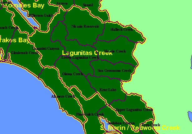
Map: 1A. Calwater Planning Watersheds, Lagunitas Creek Sub-basin |
|
This is a map of the Calwater Planning Watersheds (black labels and purple outline) in the Lagunitas Creek sub-basin. These basins
were derived by the California Department of Forestry. Bold yellow outlines are KRIS project sub-basins. Scale = 1:224,287 .
|
|
|
 |
 |
To view metadata about a map layer, click on a link in the table below.
| Name of Layer in Map Legend | Metadata File Name |
|---|
| Calwater PWS (big labels) | calw22.shp.txt |
| Subbasins (w/ labels) | subbasins.shp.txt |
| Frame Project Outline | Unavailable |