
| Area | Lagunitas Creek |
| Topic | Climate: Upper Lagunitas Cr (Lagunitas Lk) Annual Rainfall 1879-1999 |
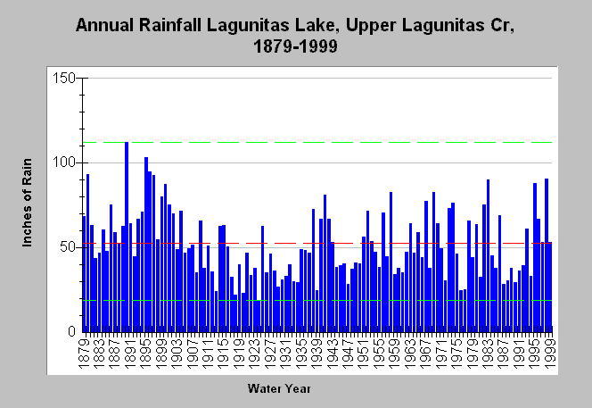
| Caption: This chart shows annual rainfall totals recorded at the California Department of Water Resources Lagunitas Lake gauging station (DWR # E20 4652 00), within the upper Lagunitas Creek watershed from 1879-1999. Other local gauges include Bon Tempe (DWR # E10 0969 00), and Alpine Dam (DWR # E10 0135 00). The dashed red line is the average rainfall while the dashed green lines are the maximum and minimums for the period of record. See Map for gauge locations and Info Links for more information. | |
 |
To learn more about this topic click Info Links .
To view additional information (data source, aquisition date etc.) about this page, click Metadata .
To view the table with the chart's data, click Chart Table web page.
To download the table with the chart's data, click rain_annual_upperlagunitas.dbf (size 5,002 bytes) .
| www.krisweb.com |