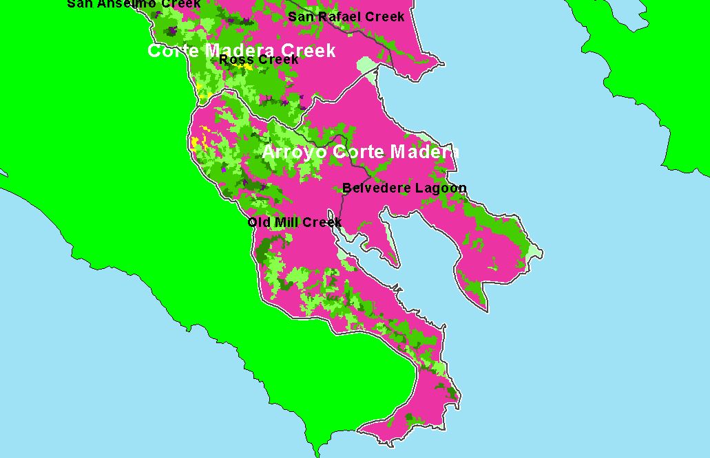
| Area |
Arroyo Corte Madera |
| Topic |
Land Cover: USFS Veg Size, Arroyo Corte Madera Sub-basin 1999 |
To view a more detailed version of this map click
here
|
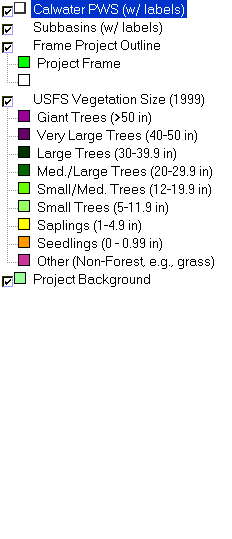
This is a map of 1999 USFS Landsat-based vegetation size data in the Arroyo Corte Madera sub-basin, overlaid on top of KRIS sub-basins and Calwater Planning
Watersheds. The lower watershed was primarily non-forested, but there were patches of forest with small-medium trees in the upland areas. The vegetation
classification is accurate at a one-hectare scale (approximately 11 pixels) and is suitable for stand classification. Data were provided by the U.S. Forest Service
Spatial Analysis Lab in Sacramento, CA. Scale = 1:114,364 .
|
|
|
 |
 |
To view metadata about a map layer, click on a link in the table below.
If you obtain KRIS on a CD and install it on your hard drive as a desktop program, you will have access to increased map capabilities such as zooming in/out, turning layers on/off, adding layers and changing legends.