| Area |
Wheatfield |
| Topic |
Tour: CGS Tombs Creek Upland Photos 2001 |
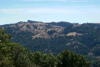 Click on image to enlarge (84K). Click here to display a larger version (155K).
View west from Oak Mountain. Photo courtesy California Geologic Survey, North Coast Watershed Assessment Program.
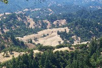 Click on image to enlarge (121K). Click here to display a larger version (238K).
View north from Oak Mountain. Photo courtesy California Geologic Survey, North Coast Watershed Assessment Program.
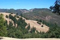 Click on image to enlarge (119K). Click here to display a larger version (222K).
View east from Oak Mountain. Photo courtesy California Geologic Survey, North Coast Watershed Assessment Program.
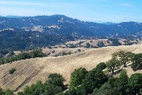 Click on image to enlarge (100K). Click here to display a larger version (192K).
View south from Oak Mountain. Photo courtesy California Geologic Survey, North Coast Watershed Assessment Program.
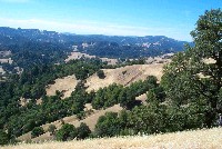 Click on image to enlarge (128K). Click here to display a larger version (239K).
Kings Ridge from Oak Mountain. California Geologic Survey, North Coast Watershed Assessment Program.
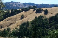 Click on image to enlarge (109K). Click here to display a larger version (209K).
Slides on east flank of Oak Mountain. Photo courtesy California Geologic Survey, North Coast Watershed Assessment Program.
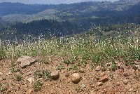 Click on image to enlarge (119K). Click here to display a larger version (212K).
Fluviatile conglomerate at top of Kings Ridge looking north. Photo courtesy California Geologic Survey, North Coast Watershed Assessment Program.
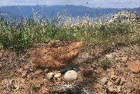 Click on image to enlarge (238K).
Fluviatile conglomerate on top of Kings Ridge looking north. Note keys in picture for perspective. Photo courtesy California Geologic Survey, North Coast Watershed Assessment Program.
 Click on image to enlarge (84K). Click here to display a larger version (155K).
 Click on image to enlarge (121K). Click here to display a larger version (238K).
 Click on image to enlarge (119K). Click here to display a larger version (222K).
 Click on image to enlarge (100K). Click here to display a larger version (192K).
 Click on image to enlarge (128K). Click here to display a larger version (239K).
 Click on image to enlarge (109K). Click here to display a larger version (209K).
 Click on image to enlarge (119K). Click here to display a larger version (212K).
 Click on image to enlarge (238K).