| Area | Basin-wide/General |
| Topic | USFS Riparian Tree Size Classes: Upper Marshall Cr CalWater 1994 |
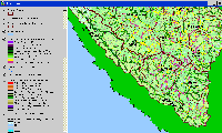
The image above is from the KRIS Gualala Map project and shows South Fork basin vegetation for a 90-meter riparian buffer strip as interpreted from a 1994 Landsat image by the U.S. Forest Service Remote Sensing Lab in Sacramento. The high Non-Forest, Sapling (trees 5"diameter) and other small diameter classes is in part owing to Ohlsen Formation, which underlies the southeastern part of the South Fork Gualala basin. Conditions along the South Fork itself vary from Small Trees (5-11.9" diameter), Small/Medium (12-19.9"diameter) and Medium/Large Trees (20-29.9" diameter). The Middle South Fork Calwater has a component Very Large (>40") and Large Trees (30-39.9" diameter), which is unique in the Gualala. This could be very important in large wood recruitment and maintaining cool water in this reach. No temperature data was available specifically for this area.
 Click on image to enlarge (120K).
To learn more about this topic click Info Links
| www.krisweb.com |
