| Area |
Estuary |
| Topic |
Tour: Gualala Estuary Photos 1997-2002 |
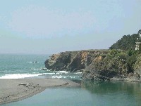 Click on image to enlarge (104K).
Gualala River estuary emptying into the Pacific on April 10, 2002. Photo provided by Patrick Higgins.
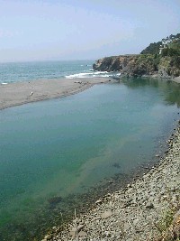 Click on image to enlarge (158K).
Pan back on the mouth of the Gualala River. Note very good water clarity, with rocks sand and algal growth on the bottom. Photo provided by Patrick Higgins.
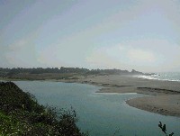 Click on image to enlarge (94K).
Gualala River estuary looking south toward Gualala State Beach on April 10, 2002. Photo provided by Patrick Higgins.
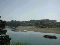 Click on image to enlarge (95K).
This photograph is also looking south but further upstream than Picture #3. Photo provided by Patrick Higgins.
 Click on image to enlarge (139K). Click here to display a larger version (180K).
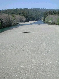
Gualala River upstream of Highway 1 Bridge on April 10, 2002. The extremely wide gravel bar with very small median particle size distribution are indicative of a high and active bedload. Photo provided by Patrick Higgins.
 Click on image to enlarge (97K).
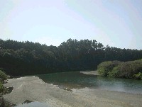
This photo shows the Gualala River estuary looking downstream off the Highway 1 Bridge on April 10, 2002. Photo provided by Patrick Higgins.
 Click on image to enlarge (137K).
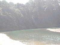
This photo shows a zoom of the same area as shown in Picture #6, looking downstream off the Highway 1 Bridge on April 10, 2002 in the Gualala River estuary. Note how shallow the estuary is except immediately adjacent to bed rock, where scour mobilizes sediment and creates a deeper area. High sediment is likely restricting carrying capacity for juvenile steelhead in the Gualala estuary and lagoon (after the mouth closes, see Picture 8). Photo provided by Patrick Higgins.
 Click on image to enlarge (21K).
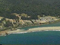
Gualala River lagoon after bar formation in the summer of 1997. Image taken from aerial video taken by Doug Simmonds.
 Click on image to enlarge (104K).
 Click on image to enlarge (158K).
 Click on image to enlarge (94K).
 Click on image to enlarge (95K).
 Click on image to enlarge (139K). Click here to display a larger version (180K).
 Click on image to enlarge (97K).
 Click on image to enlarge (137K).
 Click on image to enlarge (21K).