| Area |
Basin-wide/General |
| Topic |
Tour: Flood Stage Photos in December 2002 (also vs. low flow) |
 Click on image to enlarge (131K).
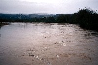
This photo shows the Garcia River at flood in December 2002. High flows are associated with both substantial sediment and bedload movement. See Picture #6 for the same Highway 1 upstream location from 1994. Photos by Peter Dobbins.
 Click on image to enlarge (42K). Click here to display a larger version (192K).
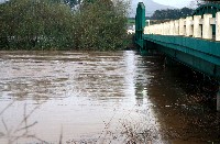
This photo was taken looking north adjacent to the downstream side of the Highway 1 Bridge in December 2002. Photos by Peter Dobbins.
 Click on image to enlarge (43K). Click here to display a larger version (187K).
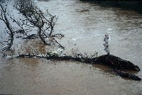
Large wood may also be transported at the river's flood stage as this large tree afloat just downstream of the Highway 1 Bridge in December 2002 indicates. Photos by Peter Dobbins.
 Click on image to enlarge (107K).
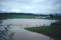
Low lying dairy lands in the Garcia River bottoms may fill with water during floods, but dairy cows are taken to high ground and little erosion results if there is good ground cover. Photos by Peter Dobbins.
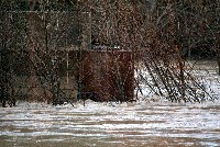 Click on image to enlarge (83K). Click here to display a larger version (254K).
This photo shows high flows in December 2002 over-topping the stream banks near Eureka Hill Bridge and rushing around out-buildings in the flood plain. Photos by Peter Dobbins.
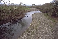 Click on image to enlarge (77K).
This photo taken in 1994 shows the Garcia River channel looking east from the Highway 1 Bridge at low flows. Photos by Peter Dobbins.
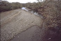 Click on image to enlarge (82K).
This photo was taken looking downstream from the Highway 1 Bridge during low flows in 1994. Picture #2 is of the same location but taken from a different angle. Photos by Peter Dobbins.
To learn more about this topic click Info Links
To view additional information (data source, aquisition date etc.) about this page, click Metadata
 Click on image to enlarge (131K).
 Click on image to enlarge (42K). Click here to display a larger version (192K).
 Click on image to enlarge (43K). Click here to display a larger version (187K).
 Click on image to enlarge (107K).
 Click on image to enlarge (83K). Click here to display a larger version (254K).
 Click on image to enlarge (77K).
 Click on image to enlarge (82K).